|
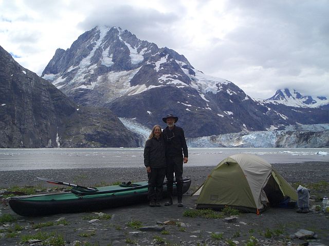
David and Pearl's 2013 Sea Kayaking Trip in Southeast Alaska From Ketchikan to Glacier Bay, via Sitka 900 Miles over 70 Days from June 2 to August 10, 2013
|
|
|
| Introduction |
| Map |
| The Kayak |
| Equipment |
| Daily Journals We have transcribed our journals (links below) with minimal editing from the entries we wrote each day on the trip, so they include information that probably is mostly interesting only to us (like when we rose and left each morning, as we always hoped we might be getting quicker), and fairly abbreviated descriptions of events, knowing that we wouldn't need a lot to jog our memories. We present them here in case some of our experiences might be of interest to others as well, especially anyone planning a trip to these areas. It should be noted that there are few photos of rough weather or large seas because when they occurred we were usually too busy to take photos and because our camera is not waterproof. There are also few photos of wildlife as compared to what we saw because our camera is very lightweight and small, but not good at detail from a distance. Daily mileages are given in nautical miles. Ketchikan to Kake (via Tongass Narrows, Clarence Strait, Sumner Strait and Rocky Pass) Kake to Sitka (via Frederick Sound, Chatham Strait, Peril Strait, Salisbury Sound and outer Kruzof Island) Sitka to Glacier Bay (via Neva Strait, Salisbury Sound, outer Chichagof Island, outer Yakobi Island, Cross Sound and Icy Strait) Glacier Bay (from Bartlett Cove up the West Arm to Johns Hopkins Inlet, back down the West Arm, then up Muir Inlet, to Muir Glacier and back to Bartlett Cove) Glacier Bay to Tenakee Hot Springs (via Icy Strait, Port Frederick and the Hoonah to Tenakee Hot Springs portage) Epilogue (a few photos from the trip home) |